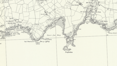
The prehistoric coastal landscape of St David’s peninsula in Pembrokeshire, Wales, boasts at least twelve coastal promontory forts including our very own Caerfai Camp.
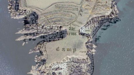
The scheduled site of Caerfai Camp / Penpleidiau Promontory Fort (PE294) occupies a very large and visually dominant natural coastal promontory located to the south-east of St Davids.
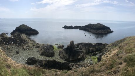
The site is located on a coastal headland, defended by cliffs on the west, south and eastern sides. The site is made distinctive as heavy erosion has created a ‘chasm’ and a sub-rectangular parcel of land connected at the very tip of the long natural promontory. Running parallel to the chasm on its northern side is a series of four banks and ditches which were constructed and adapted throughout the prehistoric period. Interesting is the way that the constructed defences appear to respect where the erosion has occurred.
The monument is described as:
“a crescent of three to four lines of banks and ditches, about 100m in length, having what appears to be a former entrance gap, about 30m across, on the east, blocked by two lesser banks. The whole set across the northern, landward approaches to a 45m wide neck of land that opens onto a roughly 100m east-west by 50m cliff-girt promontory; emplacements for circular structures have been reported but not confirmed in the interior and there is said to be a good natural, small-boat harbour to the south”.
The ramparts to the north of the fort are covered in vegetation but are still strikingly visible, showing clear lines of banks and ditches, with the inner bank standing 3m above the interior and 3.5 over the ditch on the outside. The entrance to the fort lies between the eastern end, the banks and ditches, and a steep coastal slope which runs down to the top of vertical sea cliffs. The grass-covered interior slopes gently down from north to south and is rectangular c.100m N-S and 120m E-W. On the southwest, south and east sides, the interior slopes down gently before ending in sea cliffs.
The fort itself is unusual. It is rare for a coastal promontory fort to have four lines of banks and ditch, and normally the defences are designed to seen from the landward site. At Caerfai, the flat landscape means that only the outer bank is visible, with the other banks hidden behind it. Only at the approach to the entrance can all four lines of bank and ditch be viewed and appreciated, especially to those approaching from the sea.
Little else is known about Caerfai Camp itself, except for the devastating impact that coastal erosion is having on the archaeological remains along Wales’s coastline. Coastal erosion has had a noticeable impact upon the archaeology in this region, especially at Caerfai where there a considerable amount of the site has been lost to the sea.
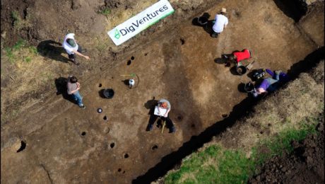
Our archaeological and paleoenvironmental research of this area will not only help to characterise the fort’s archaeological remains, but it will also help to draw wider conclusions about regional patterns of climatic variability in the past as well as identify the main processes causing the erosion.